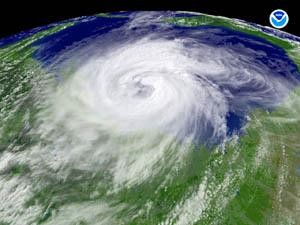
FAIRHOPE, Ala. — NOAA forecasters are expecting an “active to extremely active” hurricane season in the Atlantic Basin this year. In issuing its seasonal outlook Thursday morning, the NOAA Climate Prediction Center indicated a 70 percent …
This item is available in full to subscribers.
Please log in to continue |
FAIRHOPE, Ala. — NOAA forecasters are expecting an “active to extremely active” hurricane season in the Atlantic Basin this year. In issuing its seasonal outlook Thursday morning, the NOAA Climate Prediction Center indicated a 70 percent possibility of 14 to 23 named storms (with top winds of 39 mph or higher), including eight to 14 hurricanes (top winds of 74 mph or higher). Of those projected, three to seven could be major hurricanes (Category 3, 4 or 5 on the Saffir-Simpson Scale — winds of at least 111 mph).
The seasonal average is 11 named storms, six hurricanes and two major hurricanes. The Atlantic Hurricane Season begins Tuesday and ends Nov. 30.
Upper atmospheric winds conducive for storm development are in place, according to NOAA. Wind shear, which can tear apart storms, will be weaker because El Niño in the eastern Pacific has dissipated. Strong wind shear helped suppress storms during the 2009 hurricane season.
“When (El Niño) goes away, we’re looking at the active cycle we’ve had in place since the mid ’90s,” Bill Read, director of the National Hurricane Center (NHC), said during an interview last month in Pensacola. “It wouldn’t surprise me to see an active season.”
Robust hurricane conditions, known as the multi-decadal signal, have been in force since 1995. Seasons from then through last year have averaged about 14.5 named storms, eight hurricanes and four major hurricanes.
NOAA classifies 10 of the 15 seasons since 1995 as above normal, with seven being hyperactive. Eight of the those seasons rank in the top 10 for the most named storms, with 2005 in first place with 28 named storms. Hurricane Katrina, which devastated New Orleans and impacted Baldwin County, was among the 2005 storms.
That’s considerably different than the low-activity era of 1971-1994, which averaged only 8.5 named storms, five hurricanes, and 1.5 major hurricanes. One-half of the seasons during this low-activity era were below normal; only three were above normal (1980, 1988, 1989) and none were hyperactive.
Only five seasons since 1995 have not been above normal, which include four El Niño years (1997, 2002, 2006 and 2009) and the 2007 season.
Sea surface temperatures are also expected to be a factor this season, with above-average warmth where storms often develop and move across the Atlantic. Record temperatures of up to four degrees above average are now present in the region.
Dr. Gerry Bell, the center’s lead seasonal hurricane forecaster, said, “The main uncertainty in this outlook is how much above normal the season will be. Whether or not we approach the high end of the predicted ranges depends partly on whether or not La Niña develops this summer. At present we are in a neutral state, but conditions are becoming increasingly favorable for La Niña to develop.”
La Niña would exacerbate the current conditions in the Atlantic, according to NOAA scientists. In other words, formation of the weather phenomenon could add fuel to the fire.
“If this outlook holds true, this season could be one of the more active on record,” said Dr. Jane Lubchenco, under secretary of commerce for oceans and atmosphere and NOAA administrator. “The greater likelihood of storms brings an increased risk of a landfall. In short, we urge everyone to be prepared.”
Read pointed out that although the science behind hurricane forecasting is much more advanced than in years past, there is not yet a way to know if one particular area is at greater risk than another. That is determined by weather patterns in place a few days before a storm makes landfall.
“The biggest thing people need to understand is the seasonal forecast doesn’t tell people where hurricanes will go,” he said. “There’s nothing radically new in hurricane forecasting. The (computer) models improve incrementally each year. And we’re using a different satellite now that is in service and in position. People have several ways to get our data, and we think it’s working very well.”
Read explained although NHC operates on a six-hour forecast cycle, and streams data to weather vendors and the media, and posts on its Web site (www.hurricanes.gov) for immediate dissemination to the public, preparation now is the best way to avoid being caught short by Mother Nature.
“The time to get your act together for the hurricane season is now,” he said. “If you’re going to go (evacuate), there should be one set of plans. If you’re going to stay, there’s another set of plans.”
Since the tragic events of 9/11, Read said, emergency officials have been communicating better amongst themselves than ever before, but government cooperation should not be considered a replacement for individual preparation.
“FEMA is working across the administration and with our state and local partners to ensure we’re prepared for hurricane season,” said FEMA Administrator Craig Fugate. “But we can only be as prepared as the public, so it’s important that families and businesses in coastal communities take steps now to be ready. These include developing a communications plan, putting together a kit and staying informed of the latest forecasts and local emergency plans. You can’t control when a hurricane or other emergency may happen, but you can make sure you're ready.”
He said it’s a good idea to find out what programs are available in your community ahead of time if you will need assistance when a hurricane threatens.
Fugate’s agency has been preparing for the possibility of rough days ahead. He said, “Every year we get ready for the hurricane season, and we work to get better. We ask ourselves how we can offer better service.”
One of the ways FEMA has done that, he said, is a redesign of the agency’s Web site (www.fema.gov), in order to make it more user-friendly.
Asked what residents should expect if a hurricane makes a beeline here before all the crude oil is skimmed from the surface of the Gulf, Lubchenco said, “If there’s a hurricane in the Gulf of Mexico and it makes landfall on the Gulf Coast, some oil will go up as high as the storm surge. There is quite a bit of activity finding out where the oil is and what form it is in. We’re going to find out where the oil is and what impact is has in the ocean.”
Some are concerned about what effect oil has on Baldwin County’s underground water supply if a hurricane brings the crude inland. Fugate noted tropical systems typically bring some contamination as a general rule, whether it be saltwater or other contaminants, and that oil dissipated by a storm won’t hold together well. He said, “Oil doesn’t significantly change the risk.”
Federal officials are not attempting to downplay the effects the oil might have, according to Lubchenco, but she cautioned it must be put in perspective.
“The oil spill is a very significant disaster,” she said. “The oil (footprint) is small compared to a typical hurricane. It’s a huge difference in scale.” Much of the subsea oil that would possibly be swept up in a hurricane, she added, has already been dispersed into small droplets and is in the process of natural degradation.
NOAA scientists will continue to monitor changing conditions in the tropics, and will issue an updated hurricane outlook in early August, just before what is historically the peak period for hurricane activity.
For information about hurricane preparedness, visit www.ready.gov.